Water Horizons
Geographically Specific, Location Agnostic
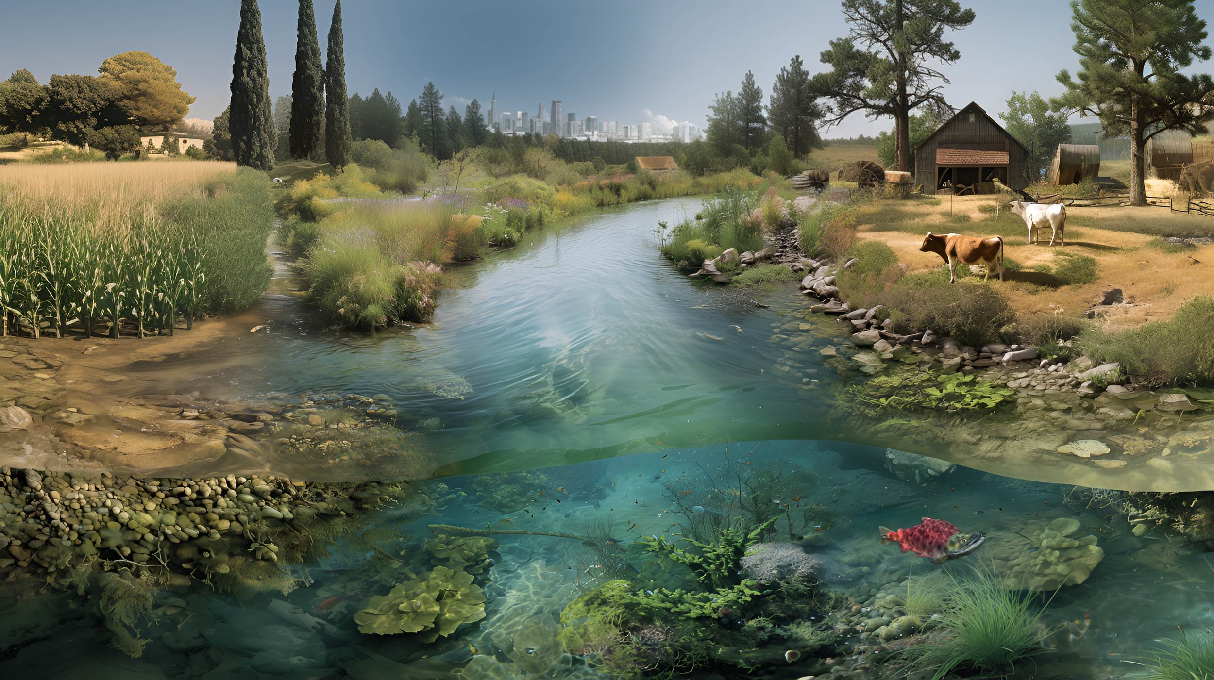
With decades of experience and a broad base of knowledge around ecosystem sciences and water resources, Water Horizons helps clients solve complex problems using geospatial data, remote sensing, spatial analysis, and project-specific models. Whether you’re looking to better understand biophysical dynamics of regions, watersheds, or rivers; quantify and prioritize multiple ecological processes for water-oriented functional outcomes, or make informed decisions about strategic directions, investments or management actions… Water Horizons is here to help.

Services
No matter the scale of the project, Water Horizons uses their technical expertise, knowledge base, and problem-solving mindset to help clients make better decisions and comprehensive plans for watershed-based, multi-stakeholder projects. Typical projects last from six months to three years, and Water Horizons values their long-term relationships. With more than two decades of experience in the environmental field, Will can help you find specialized solutions to multi-scaled, systems-oriented, water resource challenges. When a client’s needs go beyond his expertise, Water Horizons has a deep and diverse bench of high-caliber colleagues and collaborators to bring to a project team.


About Will
Will Forney received his Bachelor of Arts in Politics and Economics from Princeton University, his Masters of Environmental Management in landscape ecology and physical sciences from Duke's Nicholas School of the Environment, and his Masters of Science in watershed hydrology and biogeochemistry from Washington State University's School of the Environment. When not thinking about the solutions to challenging problems, he enjoys playing with his family and friends in whatever nature-based adventure is fitting for the season such as skiing, backpacking, rafting, or sailing.

Areas of Expertise
Water Horizons has over two decades of experience working in the environmental science and water resource management fields to move human and natural systems towards more sustainable practices. With Will Forney’s unique multi-disciplinary background, ability to translate diverse terminology between stakeholders, and spatial aptitude for quantitative analysis, Water Horizons takes a holistic view of ecological systems to find solutions to thorny problems facing society. Great care is taken to provide robust, accurate, and aesthetically-pleasing work products. Water Horizons’ experience includes collaborations with federal and state agencies, research institutions, regional planning organizations, environmental engineering firms, foundations, nonprofits, lawyers, start-up companies, venture capitalists, and private investors.

Click on the service categories for more information
Hydrology and Water Quantity
Multi-temporal investigations of surface and groundwater hydrology, urban and agricultural land use, and climate forcing functions.

Biogeochemistry and Water Quality
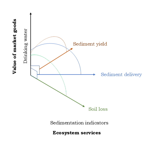
Multi-scaled analysis of biophysical processes and water quality indicators such as temperature, nutrients, sediment, and toxins.
Decision Support and Econometrics
Place-based applications of geospatial, management, and economic data to inform multi-criteria decisions and benefit-cost analyses.
Land Use and Conservation Planning
Master plans and process-based design solutions to optimize patterns of land use, conservation, and restoration in human-disturbed systems.
Innovation, Sustainability, and Investment
Market assessments, growth opportunities, and strategic guidance for sustainability-oriented companies, VCs, and individuals.

Publications
Selected publications and plans.
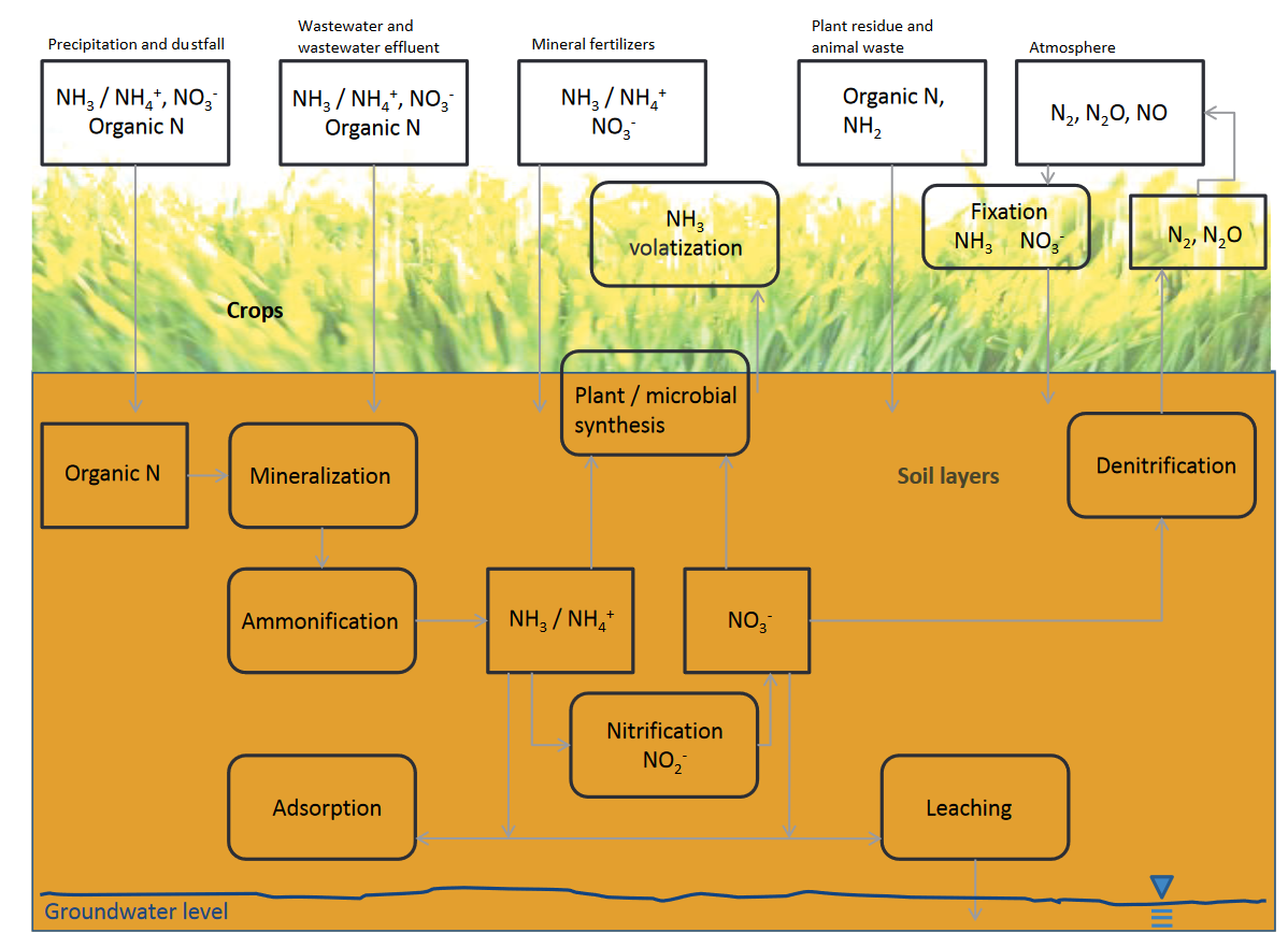
- , New frontiers in scale of traditional nitrogen budgets for a headwater system in the Cascade mountains (in draft).
- , 2025, Drinking water source area watershed-based risk assessment of agricultural pollutants with a Bayesian Belief Network, prepared for OR Joint Water Commission; submitted to NRCS National Water Quality Initiative grant, 170 p.
- , 2022, Water demand scenarios to 2050 for the Colorado Front Range, prepared for the Environmental Defense Fund, https://www.willforney.com/…/colorado-front-range
- , 2022, Nutrients across time: relationships with climate, hydrology, and land use in four rivers of the Pacific Northwest, Journal of American Water Resources Association, pp. 1–28, https://doi.org/10.1111/1752-1688.12993
- , 2021, Scientific review of the Oregon Department of Forestry’s Riparian Rule and its Riparian Function and Stream Temperature Study, prepared for Oregon Stream Protection Coalition, 20 p.
- , 2019, Catchment characteristics, water quality, and cyanobacterial blooms in Washington and Oregon Lakes, Lake and Reservoir Management, Vol. 35, pp. 51–63. https://doi.org/10.1080/10402381.2018.1518940
- , 2013, Sensitivity analysis and model assessment of the W3T Flow-Temperature model, prepared for the Willamette Partnership and National Fish and Wildlife Foundation, 6 p.
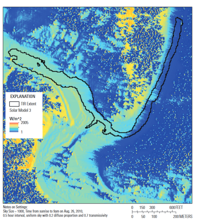
- , 2013, Salmonids, stream temperatures, and solar loading—modeling the shade provided to the Klamath River by vegetation and geomorphology, USGS Scientific Investigations Report 2013–5022, 25 p., http://pubs.usgs.gov/sir/2013/5022/
- , 2013, An integrated multi-criteria scenario evaluation web tool for participatory land-use planning in urbanized areas: The Ecosystem Portfolio Model, Journal of Environmental Modelling & Software, 34 p., http://dx.doi.org/10.1016/j.envsoft.2012.10.012
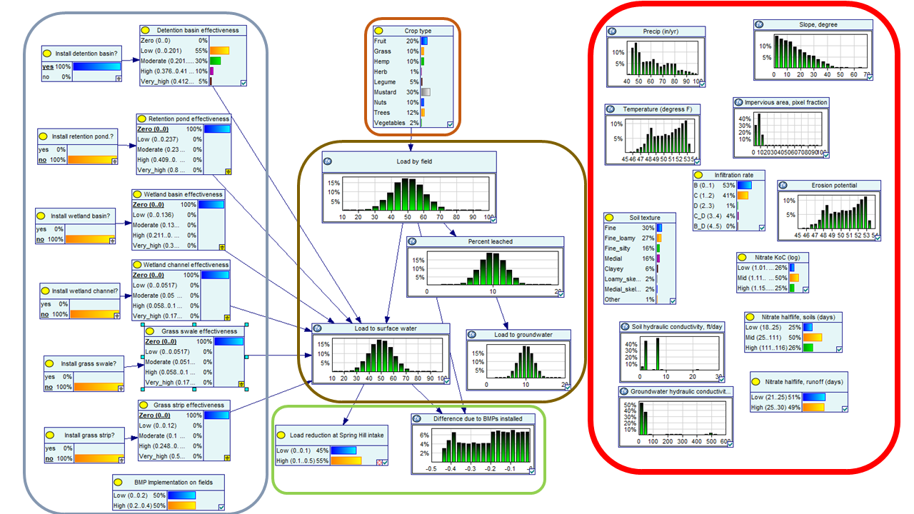
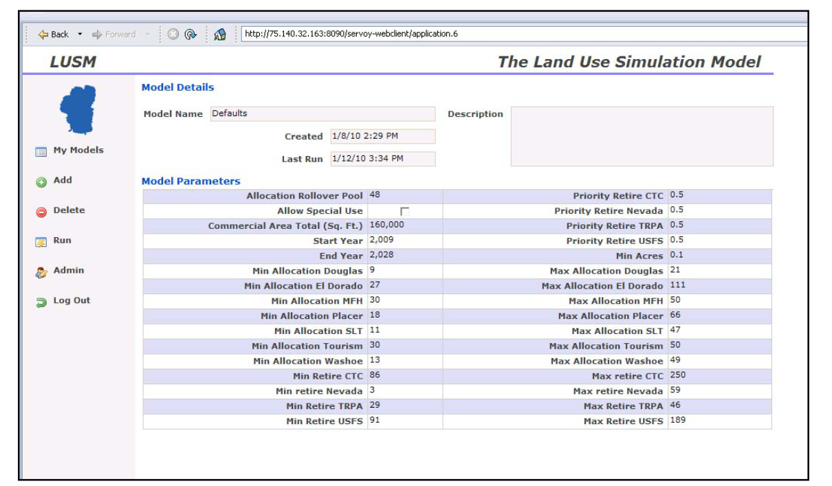
- , 2013, The development and application of a decision support system for land management in the Lake Tahoe Basin: The Land Use Simulation Model, USGS Scientific Investigations Report 2012–5229, 52 p., http://pubs.usgs.gov/sir/2012/5229/
- , 2012, An economic value of remote sensing information: Application to agricultural production and maintaining groundwater quality, USGS Professional Paper 1796, 60 p., http://pubs.usgs.gov/pp/1796/
- , 2012, Estimating the Benefits of Land Imagery in Environmental Applications. In: The Value of Information: Methodological Frontiers and New Applications in Environment and Health, Springer, R. Laxminarayan & M. K. Macauley (eds), pp. 257–288.
- , 2010, Developing a sea level rise vulnerability framework for South Florida: indicators, metrics and models, Workshop report, 21 p., http://www.vptlab.fau.edu/research/projects/FINAL_WORKSHOP_REPORT.pdf
- , 2010, A method for assessing carbon stocks, carbon sequestration, and greenhouse-gas fluxes in ecosystems of the United States under present conditions and future scenarios, USGS Scientific Investigations Report 2010–5233, 190 p., http://pubs.usgs.gov/sir/2010/5233/
- , 2007, Redwood Grove illustrative site analysis and construction details, prepared for Friends of Sausal Creek, 5 p.
- , 2007, Environmental Impact Report for the El Charro Specific Plan, State Clearinghouse #2006052112, prepared for City of Livermore, available at: http://64.165.218.18/weblink
- , 2007, Habitat Reserve Program project description, prepared for San Francisco Public Utilities Commission, CA, 139 p.
- , 2007, El Charro conceptual restoration plan, prepared for City of Livermore, CA, 12 p.
- , 2006, Draft Environmental Impact Report for the California Marine Life Protection Act: Central Coast marine protected areas project, State Clearinghouse #2006072060, prepared for the California Department of Fish and Game.
- , 2006, Draft EIS/EIR for the wetland and creek restoration project at Big Lagoon, Muir Beach, CA, State Clearinghouse #2004042143, prepared for the National Park Service and Marin County, CA.
- , 2006, Bascom Pacific LLC Pondosa Realty Tract constraints analysis, Siskiyou County, CA, prepared for State Teachers Retirement System of Ohio, 82 p.
- , 2006, Hydrogeomorphic report for Violin Canyon, Santa Clarita, CA, prepared for Caltrans and Yeager Skanska, 33 p.
- , 2006, Ecological and wildlife assessment and lagoon design, Richmond, CA, prepared for Cliff Lowe Associates and Emerald Fund, 14 p.
- , 2006, Overstreet conceptual planning maps for 30,000 acres, Gulf County, Florida, prepared for St. Joe Company, 29 p.
- , 2005, Watershed management and green building plan, Draper Lake, Florida, prepared for Zohouri Group, 12 p.
- , 2005, Butterfly Bay ecological master plan and real estate program, Tauranga Bay, New Zealand, prepared for Cerulean Properties, 9 p.
- , 2005, Montana DEQ stormwater design and permit submittal for the core of the Spanish Peaks Ski Resort, Big Sky, Montana.
- , 2002, Land use change and effects on water quality and ecosystem health in the Lake Tahoe Basin, Nevada and California: Year 1 Progress, Open File Report #02-014, USGS, Menlo Park, CA, 18 p., http://pubs.usgs.gov/of/2002/of02-014/
- , 2012, Decision-support systems for natural-hazards and land-management issues, USGS Fact Sheet 2012-3001, 2 p., http://pubs.usgs.gov/fs/2012/3001/
- , 2001, Land use change and effects on water quality and ecosystem health in the Lake Tahoe Basin, Nevada and California, Open File Report #01-418, USGS, Menlo Park, CA, 29 p., http://pubs.usgs.gov/openfile/of01-418/
- , 2000, A prototype for understanding the effects of TMDL standards: tying property values to sediment loads in the Lake Tahoe Basin, in Watershed Management Conference Proceedings, ASCE, 9 p.
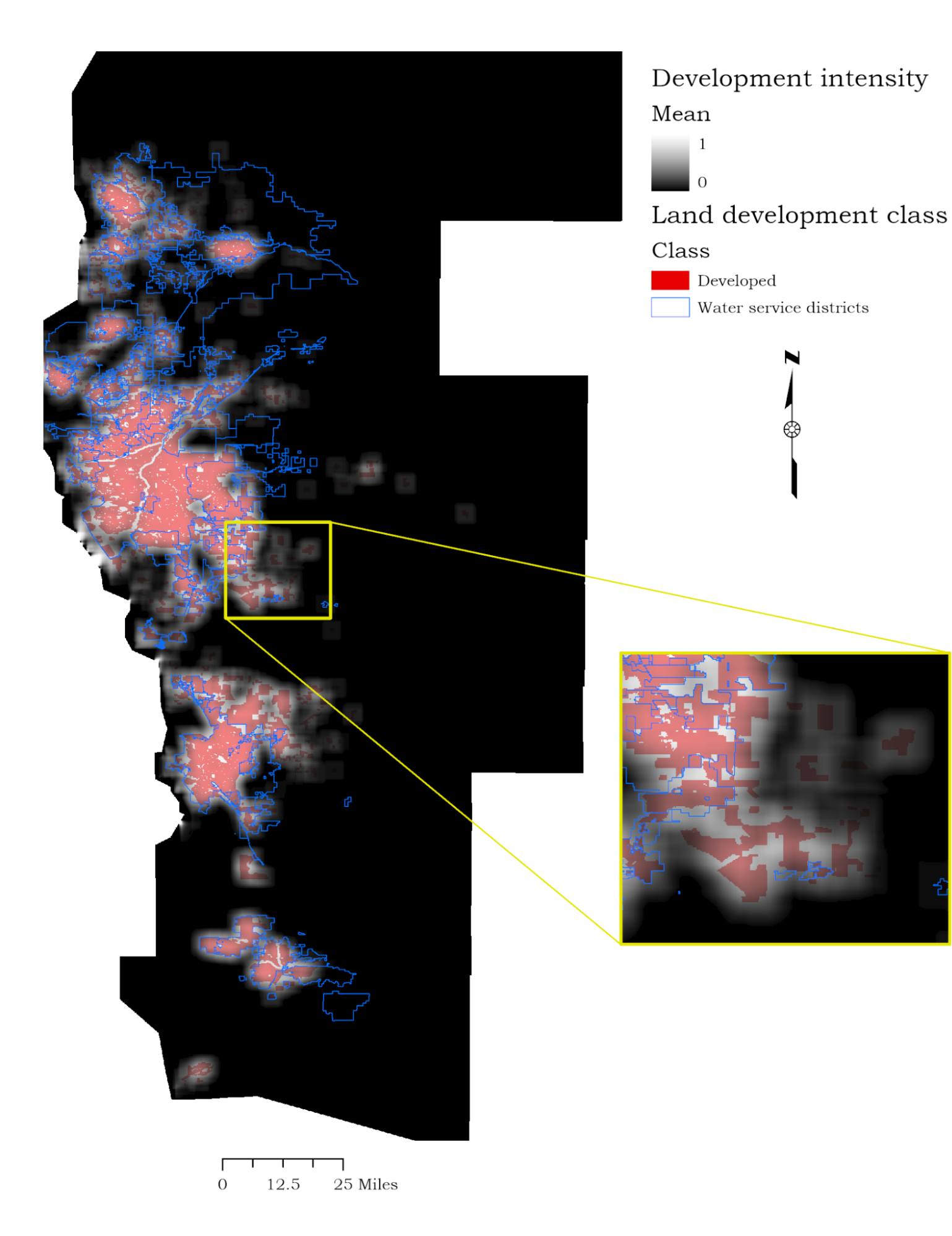
Past Projects

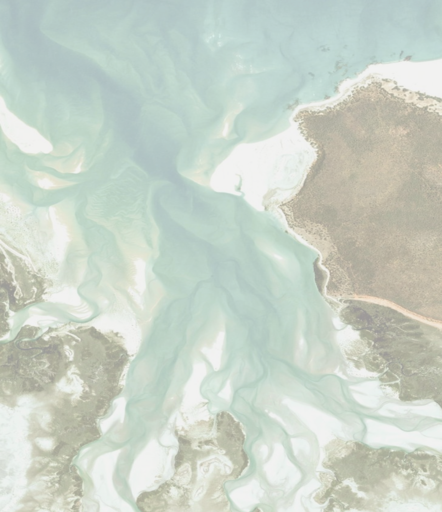
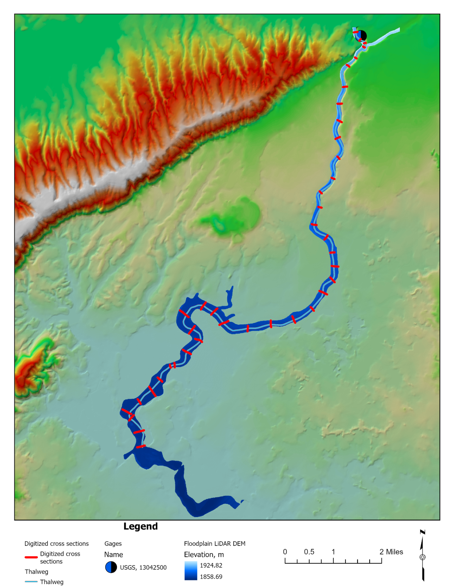
Past Project Locations
Collaborators and employers